Cloud Hill Wind Farm
A project of BayWa r.e. UK Limited near Sanquhar and Kirkconnel, Dumfries and Galloway
Project Status
In December 2025, Scottish Ministers granted planning consent for Cloud Hill Wind Farm. The project is expected to generate enough renewable electricity to supply approximately 58,000 homes and will provide a community benefit fund to support local projects, alongside measures to improve habitats for wildlife.
Details of the decision can be found here:
About the Project
Cloud Hill Wind Farm will consist of 10 turbines with a total capacity of 56 MW, generating enough renewable electricity to supply approximately 58,000 homes. The project includes over 400 hectares of land managed for wildlife, supporting species such as black grouse and wading birds, and involves restoring peatlands and wetlands and planting native trees and hedgerows to improve habitats and biodiversity.
Residents and visitors will also benefit from upgraded walking paths, new seating and signage, and better links to the Southern Upland Way, making it easier to enjoy the local countryside.
Site Location
Community Consultation & Design
The final design reflects input from local communities, Dumfries & Galloway Council, and statutory bodies including NatureScot and SEPA. Feedback from these consultations led to design changes including:
Four turbines removed from the original proposal
Substation location adjusted to reduce visual and environmental impacts
The consultation process ensured that the project balances operational requirements with environmental and community considerations, resulting in a design sensitive to the local landscape.

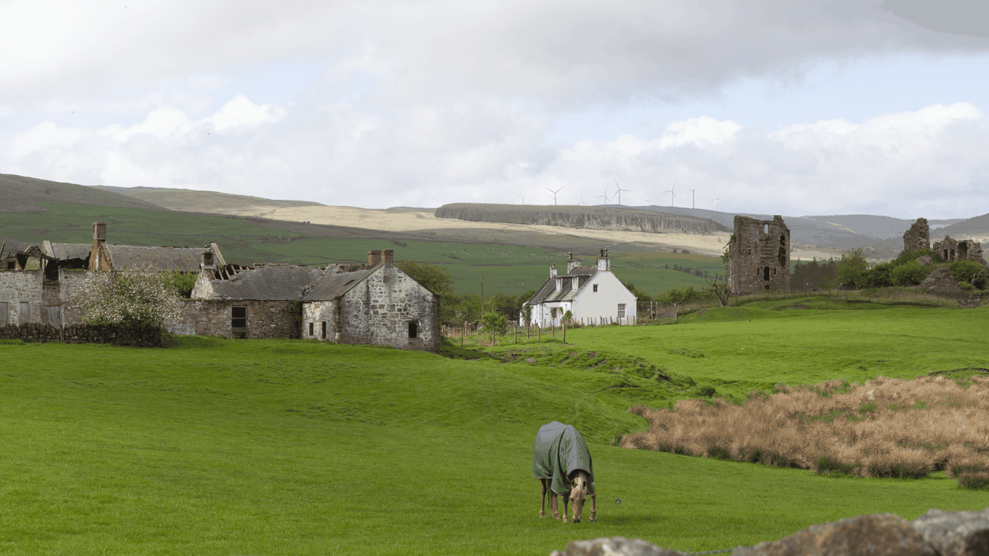
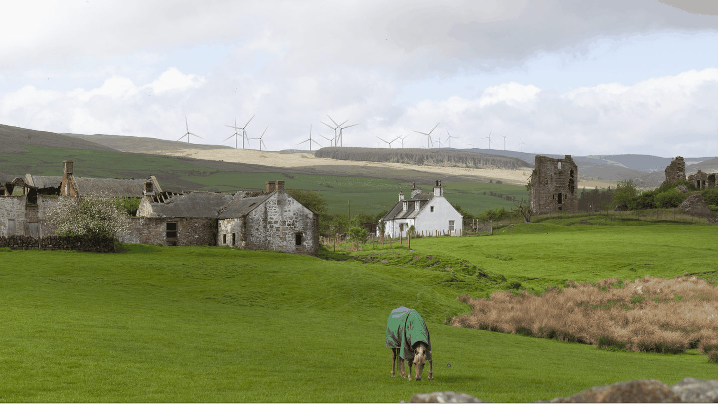
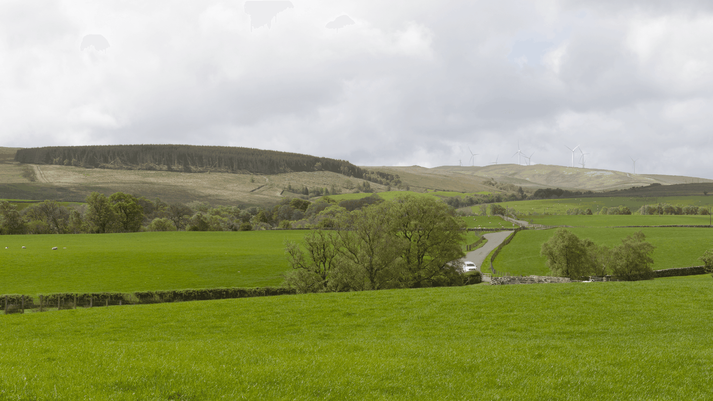
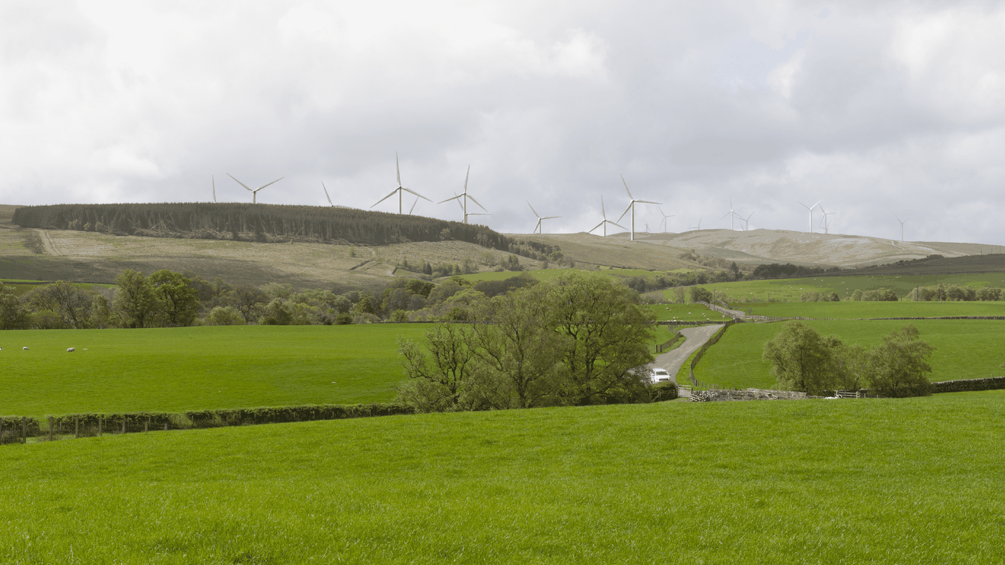
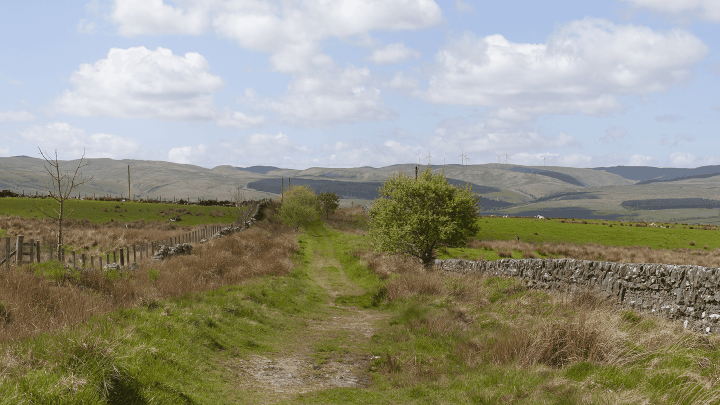
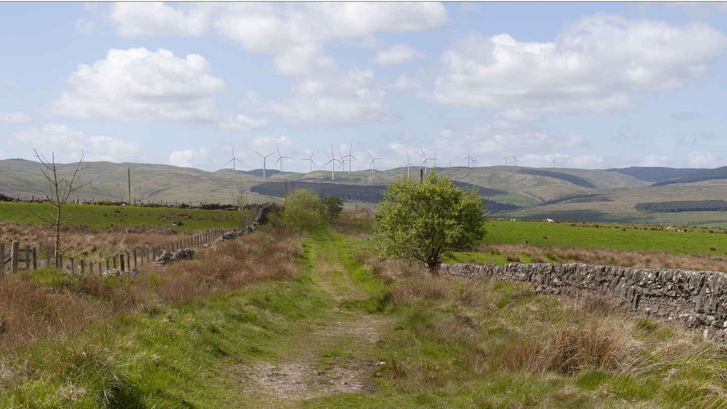
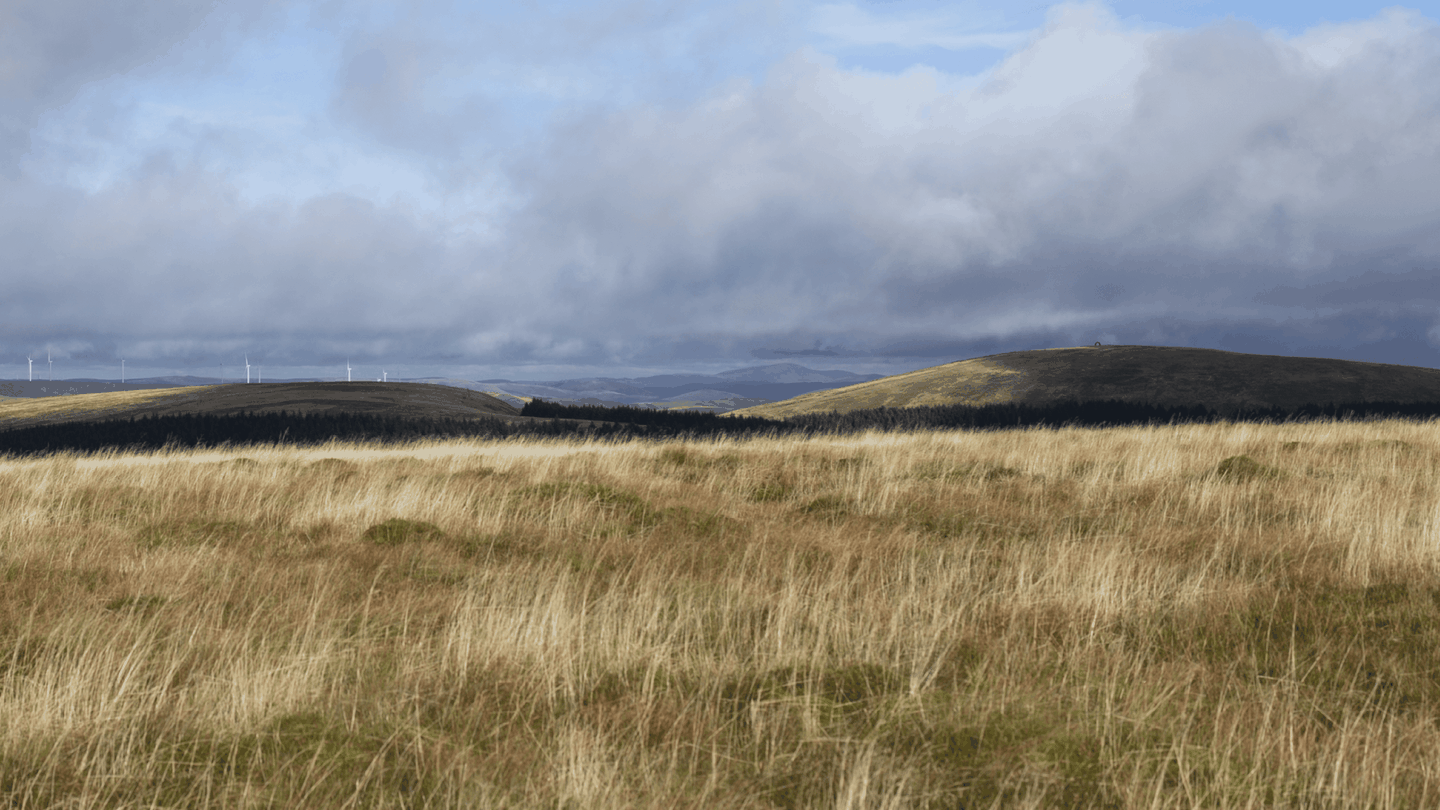
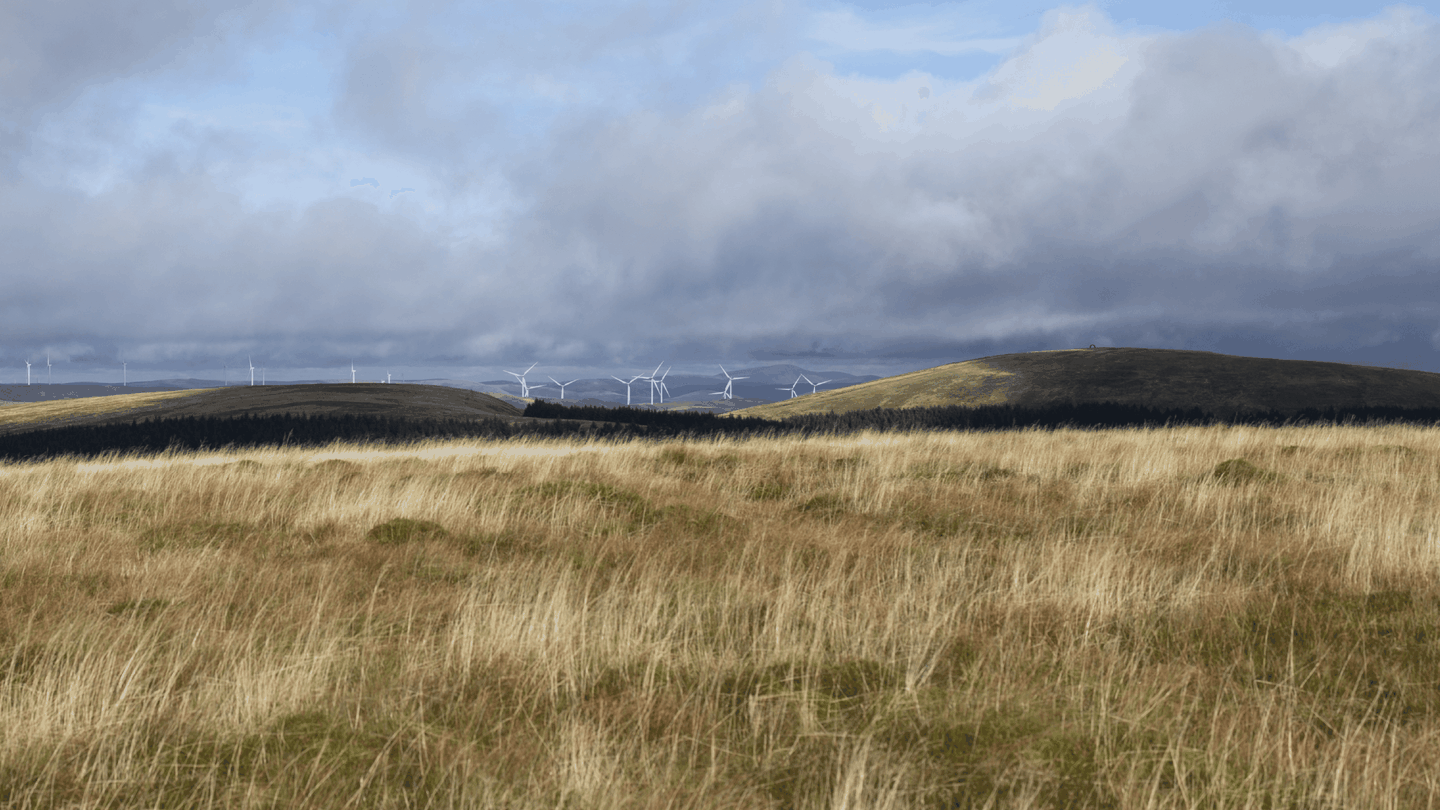
Viewpoint Image Gallery
Community and Economic Contributions
Cloud Hill Wind Farm will provide a community benefit fund of £280,000 per year, totalling over £9.8 million across the 35-year operational life. The project is also expected to contribute around £38 million in business rates, create over 90 jobs during construction, and support an estimated £5 million boost to the local economy.
Next Steps
BayWa r.e. will review and discharge planning conditions. Construction is expected to start in 2028, subject to the completion of these conditions.
*Calculated using the most recent statistics from DESNZ showing that annual GB average domestic household consumption is 3,239kWh kWh (as of January 2024, updated annually): number of megawatts installed, multiplied by a site specific load factor expressed as a fraction of 1, multiplied by number of hours in a year, divided by average annual domestic electricity consumption expressed in MWh
Additional Resources
Pre-Application Consultation Report - Appendix 1 - Combined D&G Standard Averts
Pre-Application Consultation Report - Appendix 2 - Combined Nithsdale Times Adverts
Pre-Application Consultation Report - Appendix 2 - Combined Nithsdale Times
Pre-Application Consultation Report - Appendix 3 - Combined KKS News Adverts
Pre-Application Consultation Report - Appendix 4 - Combined Online Adverts
Pre-Application Consultation Report - Appendix 5 - Posters Combined
Pre-Application Consultation Report - Appendix 7 - Combined Boards - Round 1 Exhibition LR Part 1
Pre-Application Consultation Report - Appendix 7 - Combined Boards - Round 1 Exhibition LR Part 2
Pre-Application Consultation Report - Appendix 8 - Combined Boards - Round 2 Exhibition LR Part 1
Pre-Application Consultation Report - Appendix 8 - Combined Boards - Round 2 Exhibition LR Part 2
Pre-Application Consultation Report - Appendix 8 - Combined Boards - Round 2 Exhibition LR Part 3
Pre-Application Consultation Report - Appendix 8 - Combined Boards - Round 2 - Exhibition LR Part 4
Volume 2a - Figure 3.2b - Site Design Evolution - Pre-Chilled
Volume 2a - Figure 4.6 - Indicative Substation Compound Layout
Volume 2a - Figure 4.7 - Indicative Control Building and Elevations
Volume 2a - Figure 4.8 - Indicative Wind Farm Developers Control Building and Elevations
Volume 2a - Figure 4.9 - Indicative BESS Design and Elevations
Volume 2a - Figure 7.1 - Designated Sites and Ancient Woodlands
Volume 2a - Figure 7.3 - National Vegetation Classifications
Volume 2a - Figure 7.4 - Potential Groundwater Dependent Terrestrial Ecosystems
Volume 2a - Figure 7.6 - Anabat Locations and Preliminary Bat Roost Assessment Results
Volume 2a - Figure 7.10 - Electrofishing Locations and Survey Results
Volume 2a - Figure 9.2 - Heritage Assets within 1km Study Area
Volume 2a - Figure 9.9 Designated Heritage Assets between 5-15km with Cumulatives
Volume 2a - Figure 9.10 - Designated Heritage Assets between 5-15km North West
Volume 2a - Figure 9.11 - Designated Heritage Assets between 5-15km North East
Volume 2a - Figure 9.12 - Designated Heritage Assets between 5-15km South East
Volume 2a - Figure 9.13 - Designated Heritage Assets between 5-15km South West
Volume 2a - Figure 10.4 - Extract from Carbon - Peatland 2016 Map
Volume 2a - Figure 11.5 - Groundwater Dependent Terrestrial Ecosystems
Volume 2a - Figure 12.1 - Cumulative Noise Contour Plot incl. Sanquhar II
Volume 2a - Figure 12.2 - Cumulative Noise Contour Plot excl. Sanquhar II
Volume 2a - Figure 13.2 - General Construction Traffic Route to Site
Volume 2a - Figure 13.4a - RTC Assessment A70 between the A76 and Barr Quarries
Volume 2a - Figure 13.4b - RTC Assessment A76 - Auckinleck to Sanquhar
Volume 2a - Figure 13.4c - RTC Assessment A76 - Sanquhar to Barburgh Mill Quarry
Volume 2a - Figure 14.2 - Recreational and Tourist Receptors Map
Volume 2a - Figure 14.3 - Southern Upland Way within the Site Boundary
Volume 2b - Figure 6.05a - Viewpoints Blade Tip Zone of Theoretical Visibility
Volume 2b - Figure 6.06a - Viewpoint Hub Height Zone of Theoretical Visibility
Volume 2b - Figure 6.06b - Viewpoint Hub Height Zone of Theoretical Visibility 20km
Volume 2b - Figure 6.07 - Horizontal Angle Blade Tip ZTV and Viewpoints
Volume 2c - Figure 6.23a-e VP 7 Southern Upland Way East of Sanquhar
Volume 2c - Figure 6.24a-g - VP 8 Polgown Scaur Water Minor Road
Volume 2c - Figure 6.34a-e - VP 18 Southern Upland Way Coupland Knowe
Volume 2c - Figure 6.35a-f - VP 19 Southern Upland Way Glengaber Hill
Volume 2c - Figure 6.40a-b - VP 24 Glenwhargen Scaur Water Minor Road
Volume 2c - Figure 9.14-9.27 - Heritage Visualisations - Part 1
Volume 2c - Figure 9.14-9.27 - Heritage Visualisations - Part 2
Volume 3 - Appendix 6.2 - Residential Visual Amenity Assessment
Volume 3 - Appendix 6.3 - Visual Assessment of Visible Aviation Lighting
Volume 3 - Appendix 7.1 - National Vegetation Classification - Habitats Survey
Volume 3 - Appendix 7.6 - Outline Biodiversity Enhancement Management Plan
Volume 3 - Appendix 9.1 - Archaeological Desk-Based Assessment - Part 1
Volume 3 - Appendix 9.1 - Archaeological Desk-Based Assessment - Part 2
Volume 3 - Appendix 9.3 - Setting Sieving Exercise for Designated Assets between 5 and 15km
Volume 3 - Appendix 10.3 - Preliminary Borrow Pit Assessment ERM
Volume 3 - Appendix 11.1 - Private Water Supply Risk Assessment
Volume 3 - Appendix 11.2 - Outline Water Construction Environmental Management Plan
Volume 3 - Appendix 12.2 - Background Noise Survey Record Sheets
Volume 3 - Appendix 13.1 - Abnormal Load Route Assessment - Part 1
Volume 3 - Appendix 13.1 - Abnormal Load Route Assessment - Part 2
Volume 3 - Appendix 13.1 - Abnormal Load Route Assessment - Part 3
Volume 3 - EIA Report Technical Appendices Front Cover and ToC
Volume 1 - AEI Report
Volume 2 - AEI Figure 6.7 - Horizontal Angle Blade Tip ZTV and Viewpoints
Volume 2 - AEI Figure 6.9a - Landscape Designations with ZTV
Volume 2 - AEI Figure 6.9b - Landscape Designations with ZTV (20km)
Volume 2 - AEI Figure 7.2 - Habitat Composition at the Relocated BESS and Substation
Volume 2 - AEI Figure 10.1.1 - Revised Development Site - A02
Volume 2 - AEI Figure 10.1.7 - Hazard Ranking Zonation Plan - A01
Volume 2 - AEI Figure 10.2.4 - Proposed Floating Track - A01
Volume 2 - AEI Figure 10.2.5 - Temporary Peat Storage Areas - A01